Vista Data Vision Automated Report Generation, Saving Significant Annual Costs
Connecting Rail to a Mountaintop University
The Quebec government is building Réseau Electrique Métropolitain (REM), a 67-kilometer light-rail train system that will provide the greater Montreal metropolitan area with fast, electrified public transportation. The line spreads from the south shore of Montreal to the north shore, connecting the suburban areas to the city hotspots. One of these hotspots is the University of Montreal, home to over 46,000 students.
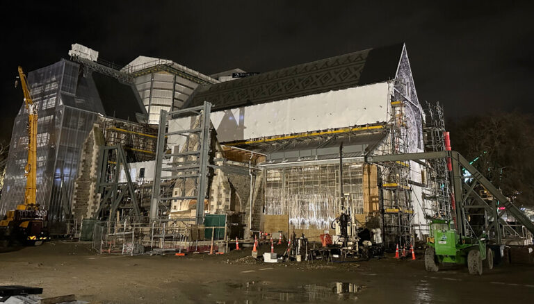
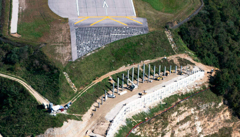
Because the University of Montreal sits near the top of Mount Royal, REM must connect to the university via an existing subway tunnel that was built between 1912 and 1918 that passes underneath the mountain. With the tunnel located some 70 meters below the location of the Edouard-Montpetit station, the connection requires the excavation of a shaft directly through hard metamorphic rock. Geophysics GPR was retained to provide vibration monitoring during the excavation to prevent damage to existing infrastructure, including university buildings, hundredyear-old water mains, and the subway tunnel, during blasting and general construction work.
Fast facts
- A new light rail line in Montreal will connect to the University of Montreal via a tunnel linking to an existing subway line.
- Connecting the new tunnel to the older subway line will require creating a new tunnel by blasting through solid rock.
- Geophysics GPR needed to provide geological data that could help determine how to undertake explosive demolition without damaging existing structures or inconveniencing residents.
Combining Data from Numerous Sensors
Excavating the new tunnel would require continual monitoring and demolition control. Beyond avoiding damage to the existing buildings and infrastructure, the organization determined that the removal of a large portion of soil could greatly change ground conditions. As a result, vibration from explosions might cause new settlement. Additionally, the organization needed to limit the vibration and noise as much as possible. To succeed the project needed to limit inconvenience to the public, as excessive explosions would run the risk of making the environment unpleasant for students and residents.
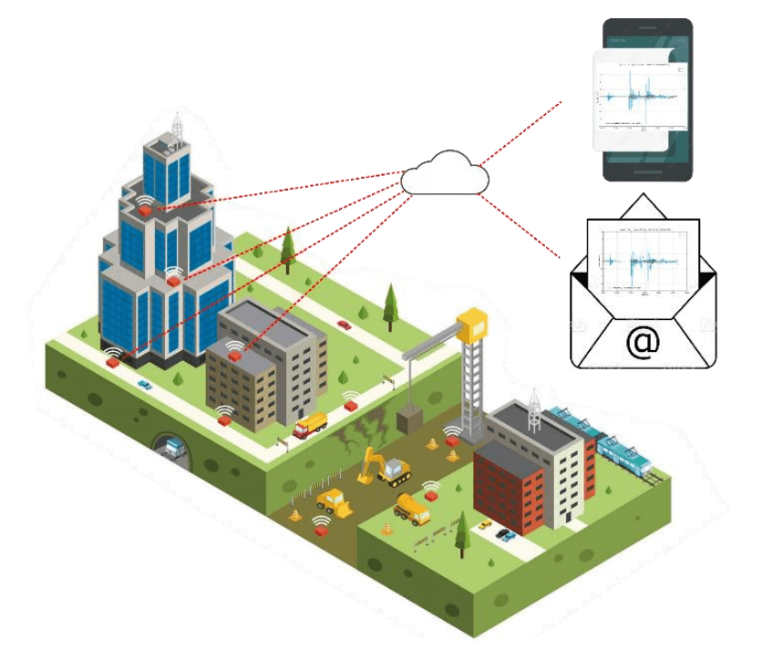
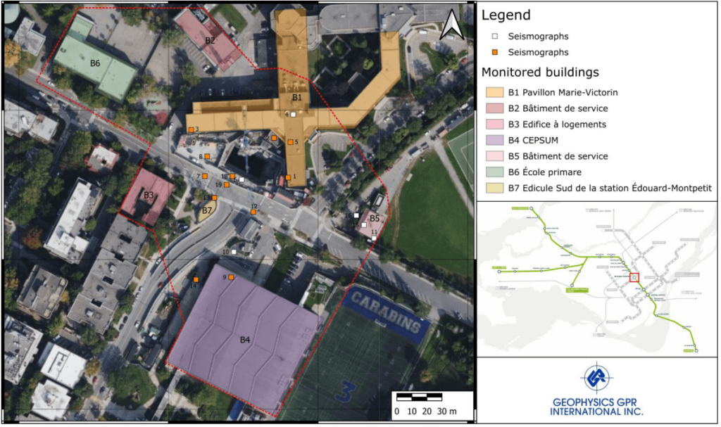
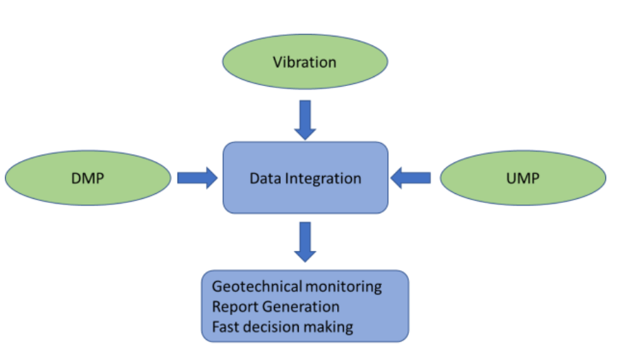
To minimize the impact from blasting, Geophysics GPR needed to carefully monitor the resulting vibrations. The scale of the project would require the use of 21 seismographs throughout the project area, with a maximum measuring range of 135 millimeters per second, and a frequency range of 1 Hertz to 350 Hertz. Geophysics GPR needed a way to quickly combine and analyze all the data in real time so the excavations strategy could be adjusted without impacting the project schedule.
“Vista Data Vision was an indispensable tool for all participants because of its ease of use, accessibility from any computer or cellphone, and convenience factor in compiling all information in one format through one point of access.”
-Charles Trottier, Technical Director, Geophysics GPR
A Single Platform for Real Time Data
Geophysics GPR determined that they could gather the seismograph data rapidly and use it to improve decision-making by using Vista Data Vision. They used the instrumentation data monitoring and management platform to gather, store, and display all field information. Local data was automatically updated to a cloud server, where the user could generate reports, check instruments, and make decisions based on this information. If the vibration amplitude passed a defined threshold, Vista Data Vision sends an immediate notification to site managers.
Geophysics GPR determined that they could gather the seismograph data rapidly and use it to improve decision-making by using Vista Data Vision. They used the instrumentation data monitoring and management platform to gather, store, and display all field information. Local data was automatically updated to a cloud server, where the user could generate reports, check instruments, and make decisions based on this information. If the vibration amplitude passed a defined threshold, Vista Data Vision sends an immediate notification to site managers.
Improving Data with More Efficient Work
By using Vista Data Vision to process geophysical data quickly, Geophysics GPR was able to quickly communicate geological data to the site team to ensure the efficiency of their work while minimizing disruption to the area. Using the collected data, the site team avoided damaging nearby structures, prevented further soil collapse, and lessened the inconvenience to residents.
Additionally, Geophysics GPR was contractually obligated to produce daily reports on geological conditions. Using Vista Data Vision for automated information gathering and report generation greatly reduced the resource hours needed perform those tasks, saving approximately CAD$ 225,000 yearly. The digital workflow improved the speed and efficiency of sharing data to all stakeholders, which in turn boosted coordination among teams. Additionally, Geophysics GPR could easily share data specific to individual facilities with property owners without having to provide data for the entire project area.
ROI
- Geophysics GPR used Vista Data Vision to instantly gather data from 21 seismographs and other sensors, then automatically generate reports.
- The automated data system improves decision-making while greatly reducing required work compared to old methods,saving approximately CAD$ 225,000 per year.
- The digital workflow greatly improved the speed and efficiency of sharing data to all stakeholders, which in turn boosted coordination among teams.