Landslides compromise safe use of highway after extremely heavy rain in Minnesota.
Problem
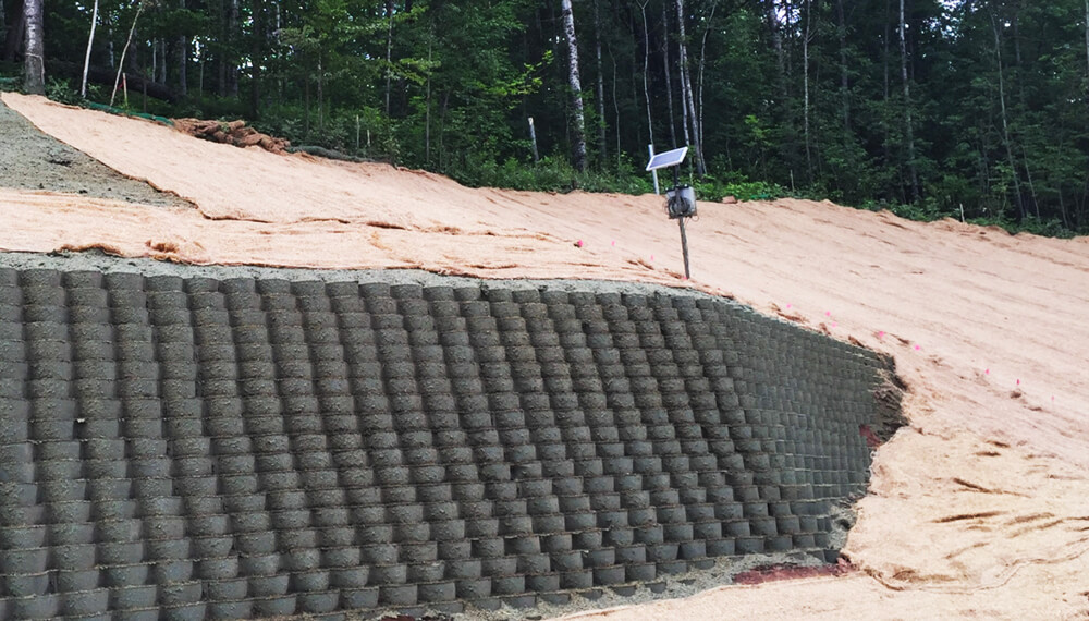
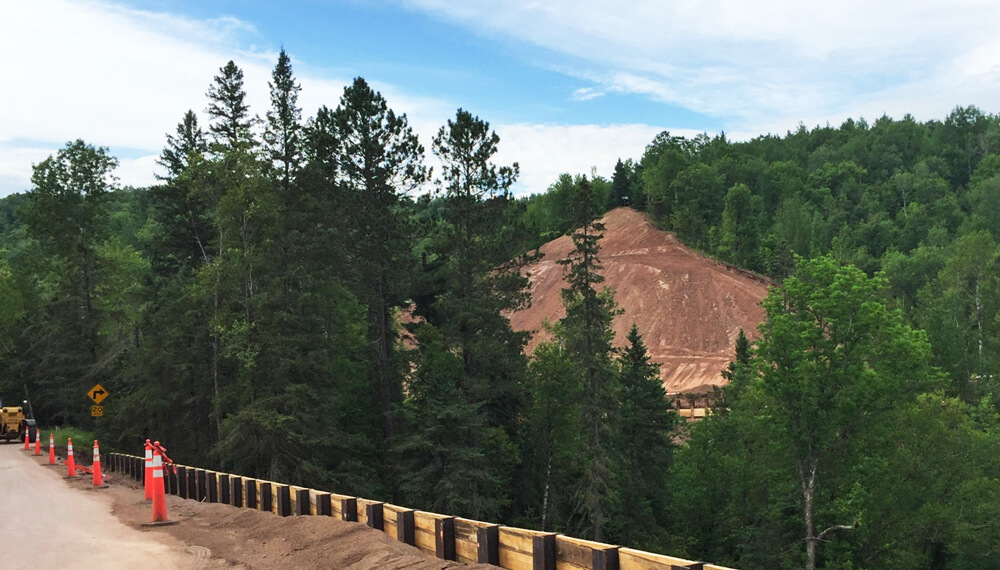
In June 2012, more than 10 inches of rain fell in two days on parts of northeastern Minnesota, saturating the ground and causing massive slope failures along Minnesota Highway 210 through Jay Cooke State Park. These landslides compromised the public’s safe use of the highway, washing out many sections of the road completely. After the event, emergency repairs were needed to allow access to a regional utility’s hydropower facility and comprehensive repairs were required to open the route back up to the public.
Using a design-build contracting framework, the Minnesota Department of Transportation (MnDOT) competitively selected the team of Veit & Company, Inc., Barr Engineering Co., and SRF Consulting Group, Inc. to repair and stabilize 74 landslide sites. These sites totaled more than 28 acres of steep slopes along approximately 3.5 miles of the highway.
Barr conducted geotechnical investigations consisting of more than 120 soil borings to characterize soil, rock, groundwater conditions, and in-situ soil strength. They then designed permanent repairs to stabilize the failed and unstable slopes as well as some interim repairs, to reduce the risk of future landslides, and to minimize long-term maintenance while preserving the natural character of the surrounding St. Louis River valley and Jay Cooke State Park.
Solution
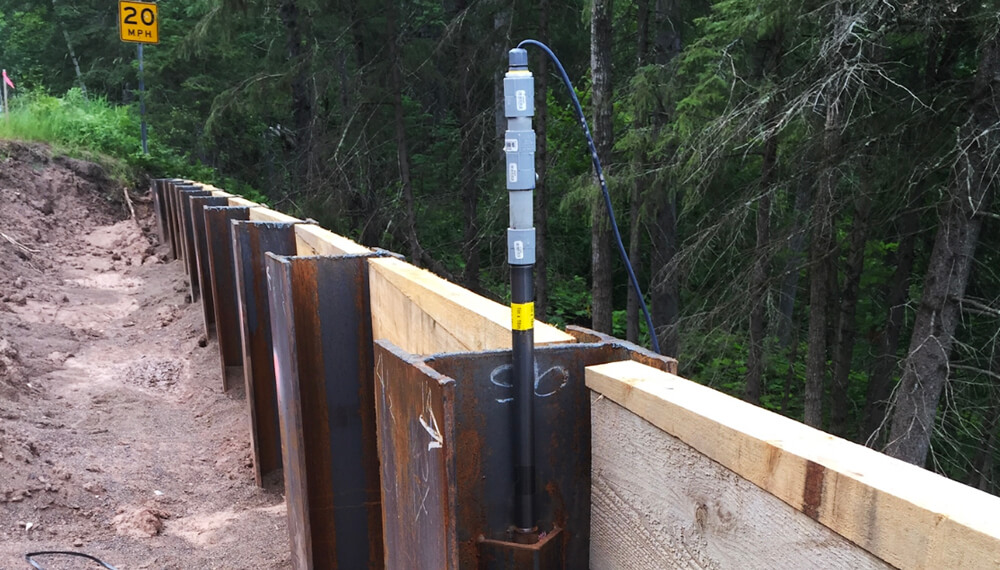
Engineers selected the sensemetrics cloud platform as the instrumentation management system used to verify the performance of the repaired highway and slopes. Barr designed and automated a project-wide sensemetrics connected network of 2,400+ monitoring points to provide comprehensive and verifiable validation of the repairs in satisfaction of the warranty agreement with the Minnesota Department of Transportation.
sensemetrics has the largest range of sensors pre-integrated for support in the platform, allowing sensor selection to be tailored to the requirements of each site repair and its unique conditions. The sitewide instrumentation program consisted of manual survey, automated survey, in-place inclinometers, vibrating-wire piezometers, tilt sensors, seepage weirs, and weather stations.
The $21.3-million project was completed and the highway reopened in 2017 with ongoing monitoring taking place for the duration of the warranty period. Barr chose sensemetrics’ cloud platform and connectivity solutions because it offered an end-to-end, plug-and-play approach with mesh networking capabilities, the capacity to integrate with a variety of sensors, and live condition monitoring with remote access to streaming data.
The reconstruction of flood-damaged Minnesota Highway 210 was named a Grand Award winner in the transportation category in the American Council of Engineering Companies (ACEC)/Minnesota Engineering Excellence contest.
Barr designed and automated a project-wide sensemetrics connected network of 2,400+ monitoring points to provide comprehensive and verifiable validation of the repairs in satisfaction of the warranty agreement with the Minnesota Department of Transportation.
Results
The $21.3-million project was completed and the highway reopened in 2017 with ongoing monitoring taking place for the duration of the warranty period.
Barr chose sensemetrics’ cloud platform and connectivity solutions because it offered an end-to-end, plug-and-play approach with mesh networking capabilities, the capacity to integrate with a variety of sensors, and live condition monitoring with remote access to streaming data.
The reconstruction of flood-damaged Minnesota Highway 210 was named a Grand Award winner in the transportation category in the American Council of Engineering Companies (ACEC)/Minnesota Engineering Excellence contest.